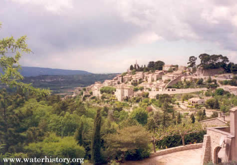
Just north of Gordes, in southern France is Murs, a scenic village with its 15th-century
castle and nearby medieval gristmills. In April 1997, a colleague and I stopped in town to get
directions to the Canyon of Veroncle.
BACKGROUND
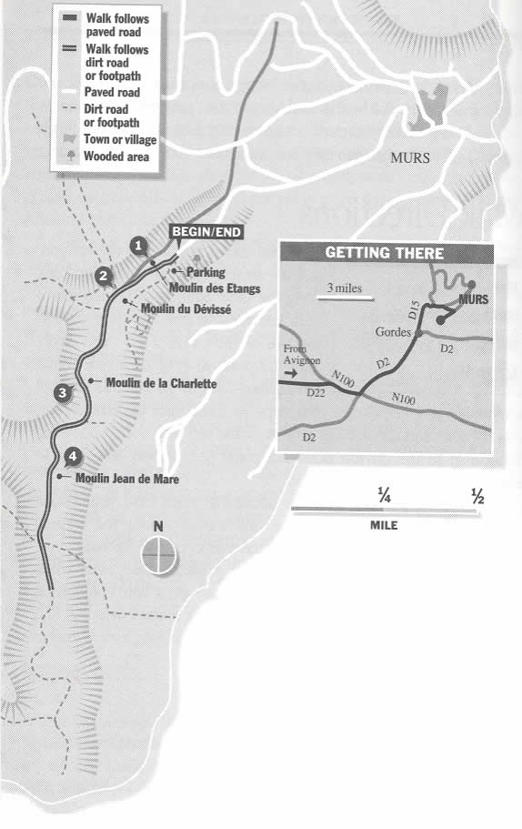
Access to the canyon is below town, just off the road to Gordes (see Illustration 1). The path down into the
canyon gives the hiker a rare glimpse into a medieval industrial complex, with its rock dam,
abandoned flour mills, and confusing array of canals. During the late Middle Ages and beyond,
it was not uncommon to build water mills one after another, piecemeal along a stream.
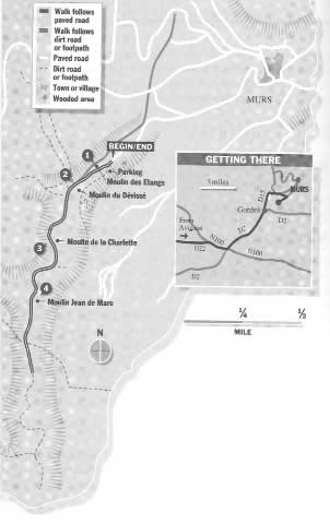
Illustration 1. Location map for the medieval mills at Murs (from Bolger and Stoller, p. 96).
 | Click on the image for a larger version. |
While the flour mills were the main reason for our visit, the hike down into the canyon was a
pleasant experience. Today the canyon is quiet and overgrown with lush flora, but 500 years ago
it was alive with sounds of rushing water, grinding mills, creaking gears, and people and animals
scurrying around with grain and flour.
To date, local authorities have done little to publicize the historic structures in the canyon.
In 1986 local organizations joined together to study the ruins, undertaking a preliminary survey.
They uncovered a surprising array of waterworks, starting with a dam and small reservoir. I read
about the medieval mills in Fodor's Short Escapes in France.
THE MILLS
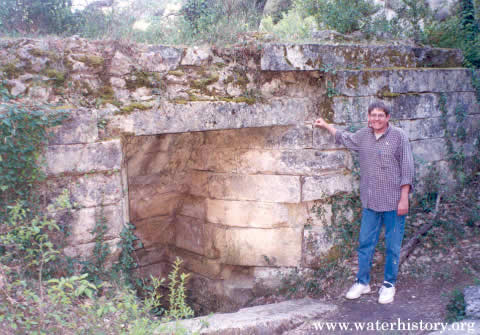
A small dam marks the entrance to what was once an extensive network of gristmills. The reservoir
behind the dam has today filled with silt which has created a grassy meadow. Below the ancient dam,
the remains of four medieval mills fill the next 3 kilometers of canyon. As we walked downstream, we
passed the ruins of one mill after another. All the mills had a similar plan. A canal excavated from
the earth fed a small reservoir. To activate the mill, a gate on the reservoir was opened and the water
escaping through the penstock drove a horizontally placed water wheel. The water wheel turned the
grinding stone above.
At Jean de Mare Mill, 2 kilometers into the walk, I examined the large canal which fed water to the
mill's penstock. Inside the mill is the ancient millstone, and underneath are the remains of a wooden
paddle wheel, which directly turned the millstone. The multi-storied stone exterior is still very much
in evidence, but today is overgrown with vines and crowded by trees.
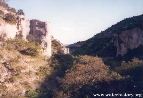
Below Jean de Mare Mill, the canyon narrows and there is a small waterfall. Water was once diverted
just above the falls and poured into a penstock. A sign now warns hikers of the perils of falling into
the vertical shaft. Below this point the canyon opens up to very dramatic effect and it is worth the
effort to continue the descent.
The origin of the medieval flour mills remains unknown. Experts date the earliest features to the
16th century. The mills were abandoned in the 19th century, when seismic activity caused a loss of water
flow. After that, they were largely forgotten. Recently, local authorities have expressed an interest
in developing the site.
REFERENCES
Bolger, Bruce and Gary Stoller, 1996, Short Escapes in France, Fodor's Travel Publications
(Second Edition), pp. 92-97.