WaterHistory.org WaterHistory.org
WaterHistory.org Search WaterHistory.org
 
WaterHistory.org WaterHistory.org WaterHistory.org
WaterHistory.org WaterHistory.org
Location Water Use Historic Era Technology Short Bios Multimedia About Home
Gallery » WaterHistory.org » Elberta » The drawing shows the spatial relationships on the Anderson Sorring…
Photo 4 of 16  |  « Previous  |  Back to Elberta  | 
The drawing shows the spatial relationships on the Anderson Sorring…
Full size image
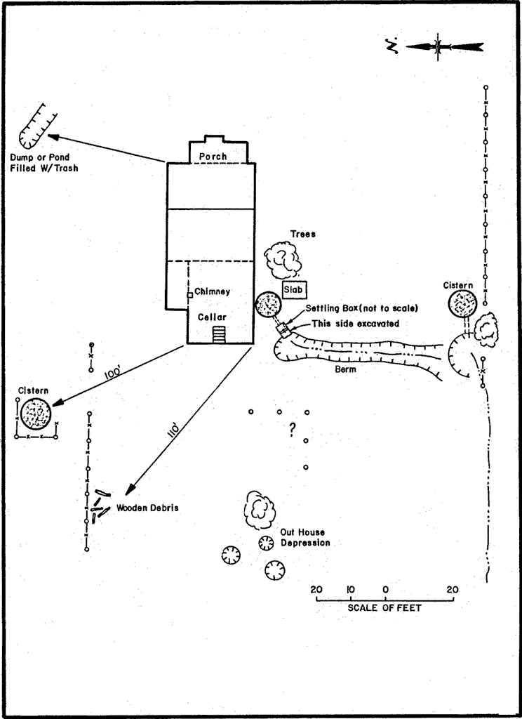
The drawing shows the spatial relationships on the Anderson Sorring property in Elberta. The two cisterns were fed from the irrigation ditch. During the winter months when there was no water in the irrigation system, the entire culinary water supply was stored in cisterns.
Photo 4 of 16  |  « Previous  |  Back to Elberta  | 
   Quick Links
 » Travel Info
 » Teaching Aids 
Programming and Design by Moki Systems, a Utah Ruby on Rails consultancy with content provided by USBR Provo Area Office.
Accu-tech Auto Wisp-router.com